Search
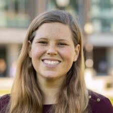
Lory W.'s Photo

Engineering PhD specializing in math, sciences, and GIS
Lory W.

79 hours tutoring

Your first lesson is backed by our Good Fit Guarantee

Hourly Rate: $60

About Lory


Bio

I am a Water Resources/Ecological Engineer with a PhD from University of Florida in Agricultural and Biological Engineering, and BS/MS degrees from Virginia Tech in Biological Systems Engineering. These transdisciplinary, ABET accredited engineering departments require expertise in mathematics (calculus, differential equations, linear algebra), physics, engineering core courses (statics, dynamics, deformable bodies, engineering economics) as well as advanced biology, chemistry, hydrology,...

I am a Water Resources/Ecological Engineer with a PhD from University of Florida in Agricultural and Biological Engineering, and BS/MS degrees from Virginia Tech in Biological Systems Engineering. These transdisciplinary, ABET accredited engineering departments require expertise in mathematics (calculus, differential equations, linear algebra), physics, engineering core courses (statics, dynamics, deformable bodies, engineering economics) as well as advanced biology, chemistry, hydrology, and soil sciences.

I have spent several years as a practicing engineer, and have passed and obtained a Professional Engineer's license. During my PhD and my time in consulting, I have become proficient in GIS software, R, and Python programming languages. I regularly help PhD students in other disciplines get started with GIS and programming.

My teaching experience includes being a graduate teaching assistant for biological engineering classes, including teaching calculus-based hydrologic engineering design and GIS courses. I have worked for a private tutoring company for two years teaching calculus and physics to college students in a one-on-one virtual setting. My approach to teaching is to give students the confidence and toolset for assessing and solving a problem based on the approaches that make the most sense to them, and the ability to "gut check" or double-check their work upon completion. I can also help with prioritization and organization of work across multiple subjects if a student has a heavy and difficult workload in college or high school.


Policies


Schedule

Loading...

Sun

Mon

Tue

Wed

Thu

Fri

Sat


Approved Subjects

Civil Engineering

Civil Engineering

I have completed BS, MS, (Virginia Tech) and PhD (University of Florida) Degrees from ABET accredited institutions in Biological/Agricultural Engineering. Therefore, I have expertise in the hydrologic portion of Civil Engineering, including rainfall-runoff processes, evapotranspiration, infiltration, stormwater infrastructure calculations and design, and hydraulic/hydrologic routing. As an environmental consultant, I specialized in stream restoration, wetland mitigation, stormwater management, and green stormwater infrastructure projects for 5 years, and passed the Civil Water Resources and Environmental Professional Engineering exam in North Carolina. My PhD work included developing a quantitative hydrologic model to assess impacts of agricultural management on streamflow dynamics.
Ecology

Ecology

I have been a practicing hydrologic/ecological engineer and researcher for 10+ years. My coursework throughout my BS, MS, and PhD degrees included extensive ecological courses, including ecology, chemistry, soil and wetland sciences, and hydrology (including environmental landscape management, pollution remediation, and mitigation). Most of my professional work includes water quality analyses as they relate to ecosystems from microscopic to landscape-level influences, as well as studies of climate change and risk. These all require deep understanding of ecological processes and principles.
GIS

GIS

I have worked in both environmental engineering consulting and engineering research utilizing GIS for map production, site assessments, engineering calculations, and landscape assessments using vector and raster data. This includes importing public and private data from various filetypes and other software (AutoCAD/Microstation, GPX, KML, TIF, TAR, etc) and accessing remote sensing datasets from online databases using APIs and Python/R code. I am proficient in Spatial Analyst (ArcGIS) and other processing procedures.
Physical Science
Lory W.'s Photo

Questions? Contact Lory before you book.

Still have questions?

Ratings and Reviews


Rating

5.0 (24 ratings)
5 star
(24)
4 star
(0)
3 star
(0)
2 star
(0)
1 star
(0)

Reviews

knowledgeable, engaging, and supportive tutor

I highly recommend Lory to anyone looking for a knowledgeable, engaging, and supportive tutor in remote sensing. I recently had the pleasure of working with her on a class project in this field. Lory's expertise and deep understanding of the subject matter were immediately evident. Throughout our sessions, Lory consistently demonstrated not only a profound knowledge of remote sensing techniques and technologies but also a genuine passion for teaching. She was patient, encouraging, and always willing to go the extra mile to ensure that I fully comprehended the material. Her insights and guidance were instrumental in helping me navigate the challenges of my project.

Artem, 6 lessons with Lory

Knowledgeable and patient tutor

Lory is a tutor I recommend, she was really patient and helpful in helping me with my practice exam. I was able to do my final exam pretty well thanks to her help.

Tina, 1 lesson with Lory

Helpful and patient tutor

Lori is helping me with a self directed research project using ArcGIS Pro. She prepared for our meeting, based on deliverables I emailed in advance. She stayed on track during our call, using our time for subjects relevant to the project and effective for the immediate assignment. I appreciated her patient demeanor and sharp focus. Highly recommend!

Elizabeth, 8 lessons with Lory
Hourly Rate: $60
Contact Lory